 The Animas River from the Durango-Silverton Railroad,
 Cascade Canyon, Colorado, April 10, 2010
You may remember we stopped at the Four Corners monument back in January, when we looped through southern Utah and Monument Valley on our way to Canyon de Chelly in northern Arizona. But it was too cold with too high a risk of snowy travel to go further north then .... we couldn't even find a campground that was open in Durango, for example. But we thought this time in April would be a good time to go back and see southern Colorado. You can decide how right we were!


You may remember we stopped at the Four Corners monument back in January, when we looped through southern Utah and Monument Valley on our way to Canyon de Chelly in northern Arizona. But it was too cold with too high a risk of snowy travel to go further north then .... we couldn't even find a campground that was open in Durango, for example. But we thought this time in April would be a good time to go back and see southern Colorado. You can decide how right we were!
But first we had to get there. We left Tecopa Hot Springs south of Death Valley (California) on Wednesday, April 7. Our goal was to stay in Flagstaff that night, and then make it to the Durango, Colorado area the next day. We drove briefly on I15 again, but soon took off across the desert toward Searchlight, Nevada, adding our 41st state.
All of a sudden we found ourselves amid dozens of Joshua Trees. We had missed Joshua Tree National Monument near Palm Springs, so I was happy to be on what turned out to be labeled some sort of Joshua Tree Highway!
This ended up being near Cottonwood, on the Colorado River, a place our church youth group used to go for water skiing camps. We filled up with diesel in Searchlight at a very pleasing price: $2.91, the cheapest we'd seen since January 18th, in northern Arizona.
We slowly descended and found ourselves moving toward the river. Laughlin, Nevada, with high-rise casinos and gambling riverboats came into view, and our first glimpse of the mighty Colorado River.


Within just a few miles we made it to Interstate 40 at Kingman, and then it was a straight 145 mile shot to Flagstaff where we stayed at Black Bart's RV park for the night.
Though we knew it would be a big drive, we wanted to make it to Durango that night. We had a couple of detours. First of all we had to find the post office in Flagstaff. Black Bart's had had a good internet connection, and we had called our accountants. Our tax return was ready and our signature authorization for electronic filing could be printed from our EMail and sent in. We have a nice printer here in Buster, so got that business taken care of. We used Google Maps on my iPhone to find the post office .... and, presto ..... taxes are taken care of.
The next detour was more fun. Gary was driving along the road when he saw a sign that said "Sunset Crater Volcano", and he remembered climbing up the side of it when he was on the trip with his mother and two brothers in 1953. He wanted to do it again .... with Liz. I skipped this as I was afraid of slipping on the loose volcanic shale.
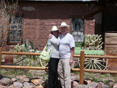
Gary and Liz at Sunset Crater Volcano, April 8, 2010
(they wear their cowboy hats a lot, don't they?)
At the Visitor Center they learned that you can no longer climb up the side of the volcano ..... too much destruction was taking place with so much hiking. But the ranger was happy to meet someone who had done it 57 years ago, and shook Gary's hand. Gary and Liz were able to take a shorter trail for a survey look at the inactive volcano.
We continued up Arizona 89, passing Cameron -- gateway to the east entrance to the South Rim of the Grand Canyon -- and past Tuba City -- gateway to the Hopi Mesas. Our good friends Andrea and Ken Hjelm had told us of their dear friends living at Hotevilla, the first Hopi mesa. It's a beautiful area. We turned east at Tuba City, and once again found ourselves on US 160, which would take us past Kayenta, AZ (we'd been there in January), on to the Four Corners area, and northeast to Cortez and Durango, CO. The Four Corners monument was closed for renovation, so we were happy we'd had our pictures taken back in January.
It was a long day of driving, and we were unable to make phone contact with the campground we wanted to stay in in Durango ... it was actually the only one our directory said would be open by early April. So we stopped at the KOA in Cortez. This terrain seen late on the 8th gave us a glimpse of the fascinating country we were heading in to.
Friday, April 9
This day was largely spent getting ourselves situated for our visit to southern Colorado. We had left about three messages at Alpen Rose Campground in Durango, and the alternative in town didn't seem like someplace we wanted to stay for four days. So we decided to drive over there, check things out in person, and collect our mail. Unfortunately, our mail wasn't there yet, but we were able to confirm that Alpen Rose was indeed open, and would be a good base for our visit to the Colorado southwestern corner. We saw those beautiful southern Rockies, the San Juan mountains in the distance, and looked forward to some great mountain adventures.
Saturday, April 10
I really wanted to ride the narrow guage Durango-Silverton railway, but that classic route doesn't run in the "winter" ..... the route doesn't open until June to allow for snow to melt. But the "winter" route runs the same track up the Cascade Canyon, following the Animas River. It's official name is the Rio de los Animas Perdidas or River of Lost Souls!
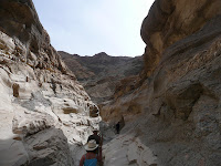
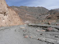
We slowly made our way north out of Durango and climbed into the granite canyon. At first the water had a tinge of green in it, but as we got higher and higher into the canyon, it turned very yellowish-brown ..... full of springtime minerals and runoff. You can see the steam drifting away as we puff along!
We saw the most interesting thing. As we neared a clearing, Gary and I both saw a squirrel with REALLY LONG EARS. It was funny, just at the edge of the clearing, that we both noticed it. When we got home, we googled -- "squirrel with big ears" and found out it was an Abert's squirrel. Isn't it interesting looking? (I got the picture from the internet!)
When we got to Cascade Creek, we stopped and the train was turned around on a spur and we ate our lunch that we packed. It was a little chilly, but it tasted delicious out in the fabulously clean air and evergreens.
Because it uses steam, the train had to stop at a water tank, conveniently situated next to a mountain stream, to take on water.
We had a beautiful ride back, appreciating the late winter beauty with snow along the rushing water. We were tired, and while had planned to go out to dinner, decided to just go "home" and find something which we did. We had cable at Alpen Rose, so tuned in to an NCIS "marathon" on USA ... we were tucked in for the night.
On Sunday, April 11 we set out in the car about noon. We only had about 200 miles as our goal ... the loop, known as the San Juan Skyway, from Durango up to Silverton, over the $1,000,000 highway to Ouray, around to Telluride, and back down. But we knew we wanted to take our time, so we packed a little bag and planned to stay overnight and take two days to make this loop. The morning dawned beautifully (we really have been very lucky with weather), and we saw these horses in the pasture outside Buster's window.
About 20 miles up Route 550 you come to Durango Mountain Ski Resort or Purgatory. We were surprised at how much snow was still around on April 11, and felt like we were just pushing the edge of the visiting season. We already told you how the railroad wasn't open all the way to Silverton, and lots of summer tourist spots weren't up and running yet.
As you drive toward Silverton, the San Juans get higher and more dramatic. And while the roads were clear, we still saw and heard a few people snow-mobiling in the mountain passes. The view down on Silverton was stunning as we descended.
Million dollar highway is a name often given to all of US 550 from Silverton to Ouray, but it technically applies only to the 6-mile section south of Ouray that follows Otto Mears' (a miner and entrepreneur) original toll road. It ranks among the nation's most spectacular scenic drives, and it doesn't disappoint. The origin of "million dollar" is disputed. It may come from the speculation that the road, through narrow gorges by steep cliffs, cost $1,000,000 per mile to build in the 1920's, OR that there is a million dollars of gold ore in the fill dirt in the road!
The town of Ouray was in a similar state of unpreparedness for tourists. One little Bistro looked open, but the owners were simply cleaning up the patio from the long winter. We did find a bagel/coffee shop still open for lunch and, of all things, they had an open mike! A nice 65+ year old man, who seemed to be fulfilling a lifelong dream to be a coffeehouse singer, sang a pretty good rendition of both Beatles and his own composition: Botoxy Baby!
Ouray seemed like a great mountain town with tons to do in the summer, too: hiking, jeep riding, hot springs, rock climbing, and in winter, ice climbing!
After lunch, the drive to Telluride through Ridgway was equally beautiful. We seemed to be inching higher and higher.
The drive along the San Miguel River as you come into town on the spur from Colorado 145 is especially lovely (above).
Telluride was another story of transitional seasons. The chairlifts and gondolas has just closed the week before, and the ONLY hotel we found in town that was open was The Hotel Telluride. A resort spa (we wanted a pool) had just closed down for two weeks to prepare for the summer season. But fortunately we did find a room. And, fortunately, it was really nice. Great cushy beds with fluffy comforters! We looked right out on the ski runs from our balcony! Gary went out and found a Mexican restaurant and brought us back "take out" as we watched a movie. Even finding someplace for dinner in this "down time" was a challenge.
Monday, April 12
We slept in a little, pulled ourselves together (great shower), and once again visited with the desk clerk, the only human we saw from the time we checked in until we checked out! She recommended Maggie's for breakfast, and was right on. I had huevos rancheros and Gary had huevos machaca, a similar burrito/egg scamble with shredded beef.
We had speculated that there must be an airport/airstrip near-by or else there's no way all the celebrities you read about would come to Telluride .... it's too difficult to get there by land. So we searched around a bit and found it ... the valley is open to the west, so as long as you can take off and land from that direction, it looks fine.
While we didn't actually read the history of the area, it seems that what happened is that as Telluride got popular, there was only so much you could develop as the town is cradled by the mountain and the mountain, of course, has only a finite number of ski runs. So they developed another mountain .... Mountain Village ... which you see below. It appears very planned with many ski in/ski out condos, a golf course, gorgeous big homes, and a free gondola that goes from Mountain Village to the ski area at Telluride so folks can park free in Mountain Village, declogging the streets of the smaller original town. As you can see, there was still enough snow (though skiing was closed for the season here, too), to outline their paths down the mountain.
We returned on the little spur that had taken us to Telluride, and continued south on 145, continuing along the San Juan Skyway. The scenery also continued ...... one majestic peak after the other this time traveling along the Dolores River canyon.
We ran into an interesting story at a roadside pullout. This was the site of the first commercial use of electricity. A power plant, the Ames Power Plant, had been built deep in the chasm along one of the forks of the San Miguel River in 1891. Lucien Nunn, who had built the power plant, was also the manager of the Gold King Mine. He, being the good manager he was, was concerned about the $2500 a month he was spending to haul coal into the mine site to burn for power. He decided to string power lines the 2.5 miles from the power plant to the mine and harness the new energy .... electricity. At the time there was still considerable debate about whether AC/alternating current, advocated by Nikola Tesla, was the better and safer choice over DC/direct current, advocated by Thomas Edison. He cut his energy bills to less than $500 per month!
As we drove down the canyon, we saw some beautiful (still wintry) images of the Dolores River. We had started to hear about Father Escalente (Grand Staircase-Escalante National Monument) and this roadside marker was our first introduction. You'll hear more about this in the next blog. Fathers Dominguez and Escalente of Spain were early (1776!) missionaries who were exploring what has come to be known as the Santa Fe Trail, a link from the Spanish mission centers at Santa Fe, New Mexico and Monterey, California.
We picked up our mail when we returned to Durango, and had a quiet day on Tuesday, April 13. We did the laundry and hung around as Liz had engaged a couple of girls from Crested Butte who were visiting with their parents. Katherine, a little older, and Savannah, a little younger, helped Gary and Liz with their science experiment: a volcano. They constructed a "cone", and used baking soda exposed to vinegar to make a bubbling mini-explosion. Fortunately, it was a nice enough day that all of this took place outside on the picnic table!
On Wednesday, April 14, we made preparations to leave. I had to drive to the parking lot of the City Market for a 90 minute conference call with Women's HealthSource, but I was glad I did. It was very productive, and it's always fun for me to reconnect with my friends and the project. Gary packed up and got Buster ready to roll and we rolled out before the 11 o'clock check out time.
We felt we had certainly nudged the seasonal envelope for a visit to the scenic San Juans, but we were happy to see the grandeur accented by snow, too. We had thought, and believe were proved correct, that we should reserve Rocky Mountain National Park, even further north, for later in the spring, so we'll do that in later May.
Now we move on to the Colorado Plateau, which I knew little about before now, but we were interested in what we could learn about this geologically unique place. It's fascinating.
Talk to you soon,
Julie, Gary and Liz


